copyright 1998, all rights reserved
Note from the Librarian &emdash; Jim’s individual write-ups are available through the RICKA Library. Jim asked that the complete package not be distributed as he may decide to publish it some day.
After year of searching, I came to the conclusion that there are very few books that describe Rhode Island's many fine waterways. The few books that do list trips in Rhode Island, only list one or two, and squeeze these trips between trips for other states.
This book is about Rhode Island's rivers, lakes and ponds. Its purpose is to make people aware of the many trips and outings that can be planned right in our own state. Whether you use your canoe to fish, for bird watching, or just to relax and enjoy the outdoors, there should be several trips just right for you. All trips start or end in Rhode Island.
While most books list only rivers, I decided to include many lakes and pond. Hopefully this will let people know where some of these lakes and ponds are. Ponds can be a relaxing place to go paddling when you don't have that second car to do a shuttle. If you happen to see a lake you're not familiar with, try it.
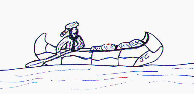
Before ever stepping into a canoe you should make sure everyone is wearing a PFD (Personal Flotation Device). The seat cushions type flotation are nice to sit on, but hardly ever end up next to you after a capsize. If you're wearing a PFD you won't have to look for it before trying to help someone else. I just can't stress enough, how important it is to wear that life jacket.
With each canoe trip you take there are certain things that you need to know. How to get to the put-in, where the take-out is and what to expect along the way. The answer to each of these items can mean the difference between an enjoyable relaxing paddle and a very frustrating time.
The directions in this book give exact mileage from a given point of reference such as an intersection. Distances from large cloverleaf intersections such as exit 5B off I-95 can be as much a .2 mile off depending on your direction of travel. Most other distances will be less than .1 mile off.
Directions to most take-out's are from the put-in. If you go with large groups this is the most convenient way to start a trip. You have everyone meet at the put-in, unload all your equipment, then run a shuttle with just the drivers and vehicles. It usually means less people and equipment to shuttle.
This method also works well with small groups as it saves reloading equipment and less people to travel back to the put-in. The people left at the put-in, can get the canoes and equipment ready while the shuttle is being run.
Read the description of any trip you plan to take. If you have a second source which references the trip, read it. That second opinion may include something important.
The river section list mostly flatwater trips with very little current. The main obstacles on most of these trips are the many dams. Each dam is unique and while most are short easy carries, some may be more difficult.
I suggest taking a drive to scout the dams before a trip is planned. Most of the dams described on these trips are accessible from a road. If the carry around one of the dams seems too difficult an alternate trip can be planned. These directions are also from the put-in.
There are a couple trips that are considered whitewater. These trips should not be taken unless you are accompanied by an experienced whitewater canoeist. Whitewater can be very dangerous if you don't understand what to expect. Even the experts sometimes get wet.
You also must make sure you have all the necessary equipment. An extra paddle, extra clothing, and wetsuits are just some of the items that are required on whitewater. A broken paddle can spell disaster or at a minimum, can end a trip if a spare paddle is no available.
The section on lakes and ponds is not meant to give a detail description of what to expect. It is more of a list of ideas for new places to try and how to get to them. I did try to give a little indication as to what each lake or pond is like.
One very important note about lakes is the affect the wind can have. The larger the lake the more you need to be concerned. Save those larger lakes for those calm summer days.
There are no long trips in this book. Each of the trips can be covered in less than a day. Most take less than 4 hours, so two trips could be combined if you want a longer paddle.
At the end of this book there is a glossary of canoeing terms. It is important to know at least the basic terms. Knowing these terms can make your canoeing experience much more enjoyable. It will also help you when reading the descriptions in this book.
There is also a short section describing the parts of a canoe and how to outfit your canoe based on your needs. This is included to help these first time canoeist, or as suggestions for these who have a little more experience.
If you are a beginner and don't have friends that are experienced canoeist, I would suggest taking at least one lesson. Most beginner lessons are inexpensive compared to what you get out of them.
You should know the correct paddle stroke for each situation or the best way to maneuver around an obstacle. Canoeing is just like any other sport. You can learn the correct way to paddle and have a good time, or get very frustrated every time you bump into something. You may even learn to out paddle some of your experienced friends.
The Information in this book was as accurate as possible at the time it was gathered. Over time conditions can change. Canoeing, like any other sport, has inherent risk which must be considered. This book is for informational purposes only and the user assumes all risk.
The Pawtuxet Watershed Trips 1 - 5
1. Big River -Burnt Saw Mill Road to Zekes Bridge.
2. Pawtuxet River - South Branch.
4. Pawtuxet River - North Branch.
5. Pawtuxet River - Pontiac Mills to Pawtuxet Village
The Pawcatuck watershed Trips 6 - 14
6. Fall River - Austin Farm Road to Route 165 (upper Wood River)
7. Wood River - Route 165 in Exeter to Wyoming
8. Wood River - Hope Valley to Alton
9. Chipuxet and Charles River's through the Great Swamp and Warden Pond
10. Usquepaug River (Queens River)
11. Charles River - Biscuit City Road to Richmond Dam
12. Pawcatuck River - Alton to Bradford
13. Pawcatuck River - Bradford to Potter Hill
16. Narrow River - Gilbert Stuart Road to the Narrows (Route 1A)
The Blackstone Watershed Trips 17 - 18
17. Branch River - Harrisville to Slatersville
LAKES and PONDS INDEX
The Information in this book was as accurate as possible at the time it was gathered. Over time conditions can change. Canoeing, like any other sport, has inherent risk which must be considered. This book is for informational purposes only and the user assumes all risk.
A. Watchaug Pond - Charlestown
B. Tucker Pond - Narragansett
C. Wardens Pond - South Kingston
D. Hundred Acre Pond and Thirty Acre Pond - South Kingston
E. Barbers Pond - South Kingston
F. Glen Rock Reservoir - South Kingston
?. Indian Lake
G. Wincheck Pond - Rockville
H. Locusville Pond - Hopkinton
I. Beach Pond - Exeter
J. Breakheart Pond - Exeter
K. Browning Mill Pond - Exeter
L. Stump Pond - Coventry
M. Lake Tiogue - Coventry
N. Silver Spring Lake - North Kingston
O. Belleville Pond - North Kingston
P. Secret Lake - North Kingston
Q. Tarbox Pond - West Greenwich
R. Capwell Mill Pond - West Greenwich
S. Wallum Lake - Burriliville (Not Completed)
T. Bowdish Reservoir - Burrilville (Not Completed)
U. Pascoag Reservoir - Glocester (Not Completed)
W. Olney Pond - Lincoln (Not Completed)
X. Brickyard Pond - Barrington